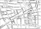
Explore JTR - Maps

Streets, Roads, and Other Locations

Sketch map from Daily Telegraph, showing the 'first-four' murders

[A] [B] [C] [D] [E] [F] [G] [H] [I] [J] [K] [L] [M] [N] [O] [P] [Q] [R] [S] [T] [U] [V] [W] [X] [Y] [Z]

The following offers general desciptions of Streets, Roads, and Locations.


A


[Back to the Top]


B

    Back Church Lane
    Originally named Church Lane until 1830-1846, running east from Whitechapel Road, (what is now part of Commercial Road), before turning south on its present route. By 1888, it ran doglegged from Commercial Road to Cable Street. Its eastern junctions were Sander, Fairclough, Boyd, Everard, and Ellen Streets, including an open access to Batty’s Gardens and a dead-end road, Glouster Buildings, just north of Boyd Street. Consisted mostly of poor and below poor with some comfortable.
    The Beehive beer retailer
    Owned by Henry Müller. 71 Christian Street. Located at the northwest corner of Christian Street and Fairclough Street. This has at times been described as a pub.
    Berner Street
    Later renamed Henriques Street after Sir Basil Lucas Quixano Henriques. Neighborhood where Elizabeth Stride was killed. Existed since 1807 as a short bye-street. Extended by 1827 and was known as Berners and Lower Berners Streets (ala Upper Berner and Lower Berner Streets). Its entire length was collectively renamed as Berner Street in 1873. It ran from Commercial Road to Ellen Street with Fairclough Street crossing near its middle. Its western junctions were Sander, Boyd, and Everard Streets, including a western pathway into Batty’s Gardens, and eastern pathway into Batty Street and another eastern pathway into Providence Street. Consisted of a mixture of comfortable, poor, and below poor. Present day Berner Street now ends at Boyd Street.
    Board School
    25-41 Berner Street. Stood at the Northeast corner of Berner Street and Fairclough Street, opposite of Dutfield’s Yard, the IWEC, and Packer’s shop. This is not to be confused with the other school in Berner Street that sat on the western side by Mission Hall, several houses south of Sander Street.
    Brick Lane
    Neighborhood of Elizabeth Stride. A fairly lengthy avenue starting from Columbia Road at its northern most point and stretching south to the junction of Wentworth Street and Old Montague Street. Consisted the fairly comfortable and those who existed either at or below the poverty level.
    The Bricklayer’s Arms public house
    Owned by Walter Robert Cook. Located at 34 Settles Street at the south corner of Settles Street and Fordham Street.

[Back to the Top]


C

    Clock, Baker’s Shop
    Located near the corner of Berner Street and Commercial Road. This baker shop should not be confused with No.2 Berner Street, Edward Sumner’s greengrocer shop.
    Commercial Road East (aka Commercial Road, ala The Commercial Road)
    Constructed by 1827 and originally ran east from New Road. Part of Commercial Road from Back Church Lane to New Road was originally called White Horse Lane (ala White Horse Street). By 1830 the two roads were collectively renamed Commercial Road. Between 1865 and 1871, Commercial Road extended westerly to junction with Whitechapel Road. By 1888, it ran slightly southeast from the junction of Leman Street, Commercial Street, and Whitechapel High Street to the start of East India Dock Road.

[Back to the Top]


D

    Devonshire Street
    Neighborhood of Elizabeth Stride and Michael Kidney. Ran south from Commercial Road, just west of Watney Street. Consisted of the very poor and the lowest class.
    Domkyrko (Cathedral Parish)
    Neighborhood of Elizabeth Stride. Its literal translation means cathedral church. Gothenburg Parish.
    Dorset Street
    Neighborhood of Majry Jane Kelly & Joe Barnett and Elizabeth Stride & Michael Kidney. Part of what has been described as the “Wicked Quarter Mile”. It junctions off the western side of Commercial Street, and lays between Brushfield Street and White’s Row. It held several lodging houses, consisting of nearly 700 beds, pubs and several chandler shops. Present-day Dorset Street is a privately owned road. Consisted of the poor, below poor, and the lowest class.
    Dutfield’s Yard
    Murder scene of Elizabeth Stride. Named after Arthur Dutfield. Located on the western side of Berner Street across the road from the Board School. Immediately on its northern side is 40 Berner Street, IWEC. On its southern side are tenements. On its western side are several businesses. The present-day site is now part of the Harry Gosling Primary School.

[Back to the Top]


E


[Back to the Top]


F

    Fairclough Street
    Constructed by 1827 and originally named North Street, until 1873. Crossed Berner Street near its mid-point. It ran east to west from Back Church lane to Grove Street. Consisted of mixture of poor and comfortable with out layers of very poor.
    Fashion Street
    Neighborhood frequented by Elizabeth Stride. One block north of Flower and Dean Street. Consisted of a mixture of poor and comfortable.
    Flower and Dean Street (aka Flowery Dean Street)
    Neighborhood of lodging house occasionally used by Elizabeth Stride. Ran west from Brick lane to Commercial Street, lying between Fashion Street and Thrawl Street. Consisted mostly of the very poor, most likely dossers, along with poor, the comfortable, and the middle class, who owned or ran businesses near the main thoroughfare of Commercial Street.

[Back to the Top]


G

    George IV public house
    Owned by Edmund Farrow. 68 Berner Street. Sat at the north corner of Berner Street and Boyd Street.
    Göteborg (Gothenburg)
    The second largest city in Sweden and a major port. It is located in the southwest of Sweden, on the Göta River. Gothenburg is less than ten miles dues east of Torslanda.
    Gower Street
    Cited residence for Elizabeth Stride when she married John Stride. Present-day 67 Gower Street is on the western side of the road, about two to three blocks north of British Museum, between University College London and University of London Senate House.

[Back to the Top]


H


[Back to the Top]


I

    India Docks
    Just south of Elizabeth and John Stride’s Poplar residence after they moved to Poplar High Street. Some present-day maps might list this as Canary Wharf.
    International Workingmen’s Educational Club, (ala International Workingmen’s Educational Society, etc.)
    Commonly referred to as the club or by its initials, IWEC. Located at 40 Berner Street, a three-story brick building that sat on the western side of the street, just four doors north of the junction of Berner Street and Fairclough Street. (Traditionally, the IWEC has been typically, but incorrectly described as a two-story wooden building due to an erroneous press account.) The building was owned by Jewish Socialists as was the publication Der Arbeter Fraint.

[Back to the Top]


J


[Back to the Top]


K

    Karl Johans Parish (Carl Johan Parish)
    Area of Elizabeth Stride’s first employment. The Gothenburg parish in the Majorna district.
    Kurhurset (later renamed Holtermanska)
    Gothenburg infirmary/hospital used by Elizabeth Stride. Its literal translation means, “house of healing.”

[Back to the Top]


L

    Leman Street Police Station
    Sat on the southeast corner of Buckle Street and Leman Street, two blocks southeast from the multi-junction of Whitechapel High Street, Commercial Street, Commercial Road, and Leman Street.

[Back to the Top]


M

    Mortuary, St. George’s-in-the-East (aka Mortuary in Cable Street)
    Mortuary used for Elizabeth Stride’s body. Situated near St. George’s-in-the-East Church, in the Public Gardens, just off of Ratcliff Street, St. George Street.

[Back to the Top]


N

    The Nelson beer retailer
    Owned by Louis Hagens. 46 Berner Street at the northwest corner of Berner and Fairclough Streets. This has, at times, been described as a pub. It was later converted to a chandler shop during 1896-1897.

[Back to the Top]


O


[Back to the Top]


P

    Pilgatan Street, Östra Haga (Philgaten, Ostra Haga)
    Alleged neighborhood of Elizabeth Stride. Situated in the eastern part of Cathedral parish. Pilgatan is known for its prostitutes. Not to be confused with the Pilgatan, Jönköping, Sweden.
    Poplar High Street, (aka High Street)
    Neighborhood of Elizabeth and John Stride. No.178 was situated on the south side of Poplar High Street, between Simpsons Road and Harrow Lane. The western end consisted of a mixture of middleclass, comfortable, and some poor.

[Back to the Top]


Q

    The Queen’s Head public house
    Owned by Richard Dipple. Located at 74 Commercial Street at the south corner of Commercial Street and Fashion Street, just one block north from Flower and Dean Street.

[Back to the Top]


R


[Back to the Top]


S

    St. Giles in the Fields Church
    60 St Giles High Street. Church where Elizabeth and John Stride were married in 1869. Part of the diocese of London in the Church of England. Founded by Queen Matilda, wife of Henry I as a leper hospital and chapel. St Giles is the patron Saint of Outcasts. John Marjoribanks Nisbet, Canon Residentiary of Norwich, was St. Giles’ presiding rector at the time of the Stride’s wedding.
    Settles Street
    Originally named Gloucester Street until 1877-1888. It ran south from Charlotte Street to Commercial Road. Its junction with Commercial Road was opposite of Christian Street and Commercial Road. It consisted of poor and comfortable with outer fringes of very poor.
    Sick Asylum, Poplar Stepney (aka Bromley Sick Asylum)
    Complete by 1871. It was situated at Devons Road, Bow, almost one mile due north from the junction of Chrisp Street and East India Dock Road. In 1875, a nursing school was incorporated. By 1920, it was renamed, St. Andrews Hospital, which is still in use.
    Stora Tumlehed (ala Stora Tumelhed)
    The traditional name given to Elizabeth Stride’s family farm. This is more than likely the name of the village, since there is also a Lilla Tumlehed. In Swedish “Stora” means big while “Lilla” means small, and “Tumlehed” itself, loosely translated, means ‘tumble moor’ or ‘tumble heath.’ (In America, this might be similar to the names of “Little Round Top” and “Big Round Top” or ‘rolling hills,’ which are actual places and not a farm’s name.) Today, the village called Tumelhed is less than one and a half miles driving distance to the northwest from Torslanda.
    Swedish Protestant Church (ala Swedish Church)
    Church where Elizabeth Stride registered after her arrival in London in 1866. Situated in St. George’s-in-the-East district within Prince’s Square, which was east of Well Close Square between Cable Street and Saint George Street, (present-day The Highway). Not to be confused with the two locations of the modern-day Swedish Church of London whose Parish Church is at Harcourt Street, Old Marylebone Street, and their Seaman’s Church located on Lower Road next to Southwark Park. The Seaman’s Church was not established until 1899 and should not be confused with another contemporary church, the Sailor’s Church that sat to the west in Wellclose Square

[Back to the Top]


T

    The Ten Bells public house
    Owned by J Waldron. 84 Commercial Street. Situated on the northeast corner of Fournier Street. It is approximately one block north from the corner of Flower and Dean Street and Commercial Street. The Ten Bells still exists and has been home to the Cloak and Dagger Club for many years.
    Torslanda (ala Torlands)
    One of 21 Gothenburg districts. Located on the island of Hising, by the North Sea in the northwest part of Gothenburg. Present-day Torslanda is well known for its Volvo automobile-manufacturing plant.
    Torslanda Kyrka (Church of Torslanda)
    Church attended by Elizabeth Stride and her family. It still exists. One of the oldest churches in Gothenburg, housing at least one item, which dates back to the early 12th Century. Part of the Gothenburg diocese for Evangelical Lutheran, the Swedish religion.

[Back to the Top]


U

    Usher Road
    Neighborhood of Elizabeth and John Stride. Ran north to south from Old Ford Road and Tredegar Road, crossing Roman Road. Situated south of Victoria Park and west of Parnell Road, supporting a mixture of poor and comfortable.

[Back to the Top]


V

    Vestry Hall (aka St. George’s-in-the-East Hall)
    Site of the Stride Inquest. Located just northeast from St. George’s-in-the-East Church on the southern side of Cable Street, west of Canon Street Road.

[Back to the Top]


W

    Westow Hill, Crystal Palace
    Approximately five miles overland to the south, from Berner Street. The Crystal Palace, a large glass hall created by Sir Joseph Paxton, was relocated across the Thames from Hyde Park to the Southeast of London in Upper Norwood after the Great Exhibition of 1851. The exhibition building stood from 1854 until it was destroyed by fire on November 30, 1936.
    Workhouses
    The first recordings of a workhouse was in Exeter, 1652 and in Abingdon, 1631. Workhouses were established as a social program to aid the poor, although they were ill equipped to deal with mass poverty on a large scale. Unlike younger married inmates, elderly pauper couples were permitted to share a bedroom.
    Workhouse, Poplar
    First workhouse attended by Elizabeth Stride. Established in 1735. Since 1757, the Workhouse was located on the south side of Poplar High Street, just east of Wade Street. Between 1871-1882, the local Government Board conducted an “experiment” whereby the Poplar Workhouse would only accept “able-bodied paupers” who were subject to a “labour test.” This was intended as a deterrent. The workhouse’s controlling authority eventually established a "labour colony" for able-bodied men in 1904. By 1930 only 150 older men lived there.
    Workhouse, Whitechapel & Spitalfields
    Second workhouse attended by Elizabeth Stride. The first Whitechapel Workhouse was established in 1724 with the Whitechapel Poor Law Union being formed on February 16th, 1837. Several new structures were built between 1842 and 1872, in an attempt to improve conditions with accommodations handling nearly 700 people. There were several locations: The Casual Wards at 35 Thomas Street (renamed Fulbourne Street, present-day Lomas Street); The Infirmary at the corner of Thomas Street and Charles Street (renamed Baker’s Row, present-day Vallance Road); and, the location for the workhouse was known as South Grove. After 1930, the London Council took over the operations, and the Infirmary became known as St Peter’s Hospital, which was demolished in the 1960s.

[Back to the Top]


X


[Back to the Top]


Y


[Back to the Top]


Z


[Back to the Top]


Many THANKS to the sources that have contributed to this page:
A-Z
ARU
BLPM
CBJTR
Daily News
Daily Telegraph
Evening News
FSOL
GBA, 1888
GFP, 1888
HITM
JPVE
JTRDH
JTRUF
MOL
MQ
MSEE
MWOD
NFW
OSM, 1894
PI/AMP
RBRM
Ripperologist, No.22 & No.23
RUKI
SCL
SF
SGFC
Times
TPC
VLM;
WW


[Back to the Top]