|
Explore JTR
- Maps
|
|
|
Explore JTR
- Maps
|
|
|
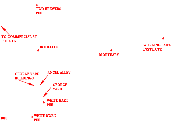
[Area Map]
[Description]
[Detail Map]
|
|

|
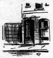
1. George Yard Buildings (murder scene) 2. Wentworth Street 3. Angel Alley 4. The White Hart Pub 5. Whitechapel High Street |
For sources used, refer to the Time Line of the specific victim.
Many THANKS to the people who have contributed to this page:
Geographical assistance - Courtesy of The Viper.
George Yard image - Courtesy of New York Herald.
Pub addresses - Courtesy of Ripperologist, issues #22 and #23.
88 detail map extract - Courtesy of Goad's Fire Plan via The Viper.
88 area map extract - Courtesy of G. Bacon's New Large-Scale Ordnance
Atlas.