|
Explore JTR
- Maps
|
|
|
Explore JTR
- Maps
|
|
|
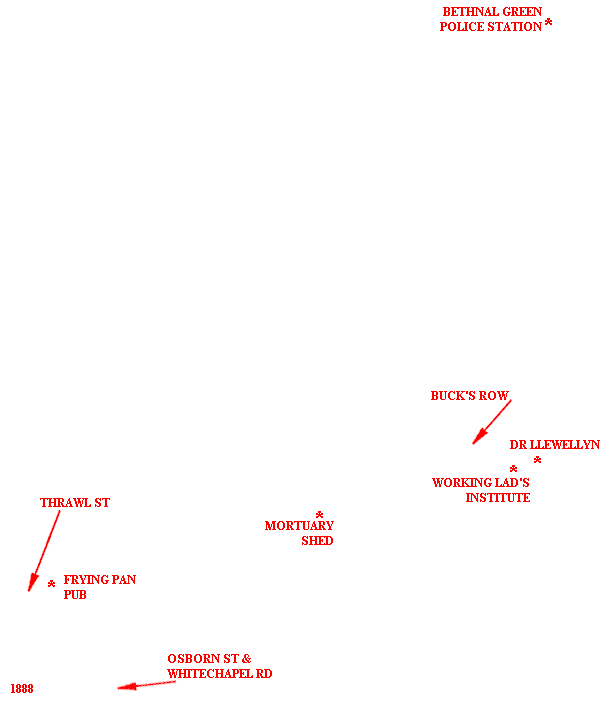
[Area Map]
[Description]
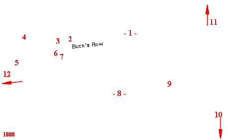
[Detail Map]
|
|
|
1. Browne & Eagle Ltd Wool Whses 2. Schneider's Cap factory 3. Walter & Mrs Purkiss (Essex Wharf) 4. Eastern London Railway 5. Board School 6. Brown's Stable Yard (murder scene) 7. Mrs Green (2 Buck's Row) 8. Tomkins, Britton, & Mumford (Barber Knacker's Yard: slaughter house) 9. Patrick Mulshaw (Sewage Works) 10. To Whitechapel Road & Dr Llewellyn's Surgeory 11. To Bethnal Green Police Station 12. To Baker's Row & Hanbury St |
For sources used, refer to the Time Line of the specific victim.
Many THANKS to the people who have contributed to this page:
Geographical assistance - Courtesy of The Viper.
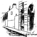
Buck's Row image - Courtesy of New York Herald.
Pub address - Courtesy of Ripperologist, issue #22.
88 detail map extract - Courtesy of Goad's Fire Plan via The Viper.
88 area map extract - Courtesy of G. Bacon's New Large-Scale Ordnance
Atlas.