|
Explore JTR
- Maps
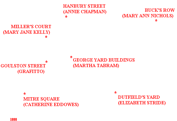
The Whitechapel/Mitre Square Area: 1888
|
|
|
[Area Map]
[Description]
This map deals with the area of Whitechapel and Mitre Square from 1888.
|
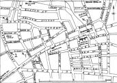
AREA MAP
[Back to the Top]
DESCRIPTION
The "London Police" is segragated into two forces:
The City of London Police has jurisdiction over the one square mile
of the City proper.
The Metropolitan Police Force, which comes under control of the Home
Secretary, has jurisdiction of London outside of the City proper.
Like most boundries, the "border" between The City proper and the East End of Metropolitan
London, is not a neat circle. However, by walking past Middlesex Street, from Aldgate High Street into Whitechapel High Street, a person enters the East End and Whitechapel.
Of the 900,000 estimated residents of the East End, 80,000 lived in Whitechapel.
Between 1850 and 1888, many unemployed and numerous immigrants went to London, tripling its immigration population. West London expanded faster than contractors could build, and the area East of Aldgate Pump was left for slum living.
In the 1870s and 1880s, slumming was a "fashionable" past-time.
In 1883, the London School Board reported that over 75% of the families with children lived in only a single room.
In October 1888, the Metropolitan Police estimated that there were 1,200 street walkers and 62 brothels in Whitechapel.
[Back to the Top]
Many THANKS to the people who have contributed to this page:
Map image - Courtesy of Daily Telegraph via Alex Chisholm.
88 area map extract - Courtesy of G. Bacon's New Large-Scale Ordnance
Atlas.
[Back to the Top]